Camino routes in Slovakia

HomeCamino routes in Slovakia

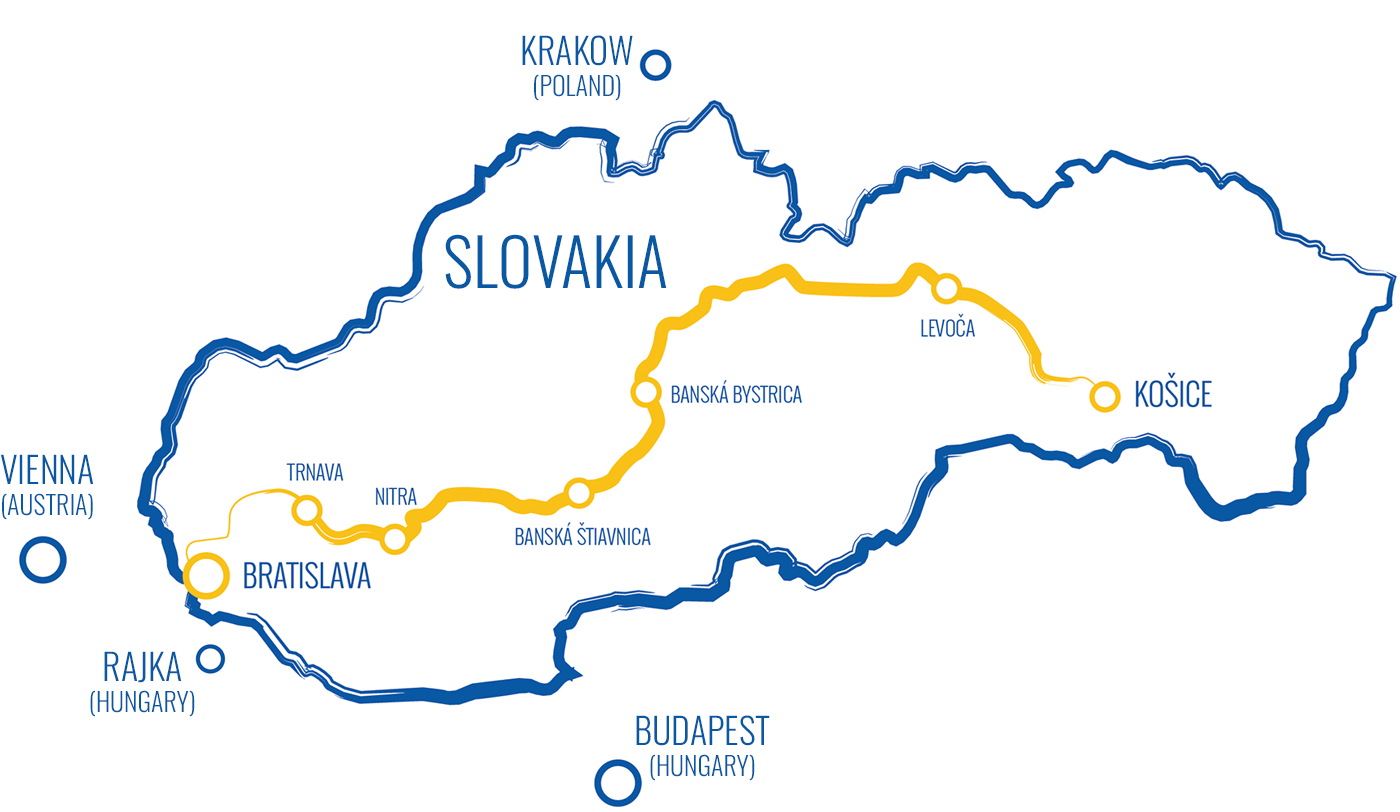
The first marked Way of St. James in Slovakia connects the two largest Slovak cities, Košice in the east, and the capital Bratislava in the west. Bratislava is the junction point of three different Caminos. Hungary’s Szent Jakab út meets Slovakia’s Svätojakubská cesta at the ruins of St. James Chapel at the very heart of Slovakia’s capital. It is at this point that the first stage of Austria’s Jakobsweg actually begins, just a few kilometres before the Austrian border.

This first marked Slovak Camino route is about 650 km long and will take you about a month on foot.

In Slovakia, the Way of St. James follows traditional trade corridors used since times immemorial, passing through the main churches devoted to St. James, as well as through major natural, religious and cultural landmarks. It is an attractive and easily accessible route that copies as much as possible the historical pilgrimage routes used in the middle ages while providing pilgrims with the necessary infrastructure to secure their safety and comfort.

Route sections

The Way of St. James in Slovakia is divided into nine sections, each section consisting of several day stages.

Eastern Slovakia

Central Slovakia

Western Slovakia

Northern Slovakia and Váh river valley

  • Oščadnica - Trenčín on foot (coming soon)
  • Trenčín - Trnava on foot (coming soon)

Foot routes overview

SectionDistanceStagesAscentDescentAbout the section
Košice – Levoča100 km53 225 m 2 883 m  More
Levoča – Banská Bystrica190 km103 143 m 3 214 m  More
Banská Bystrica – Hronský Beňadik133 km53 209 m 3 500 m  More
Hronský Beňadik – Trnava128 km61 983 m 2 028 m  More
Trnava – Bratislava83 km41 402 m 1 408 m  More
Bratislava – Wolfsthal (AT)11.2 km156 m 45 m  More
Rajka (HU) – Bratislava24.8 km189 m 75 m  More
Oščadnica - Trenčín????? m ??? m 
Trenčín - Trnava????? m ??? m